The Retired Engineer in a Cornfield Who Beat the Weather Service at Its Own Game
Weather forecasting is, by any reasonable measure, one of the most technically sophisticated endeavors in modern science. The National Weather Service operates hundreds of official observation stations across the country. It processes satellite imagery, radar returns, and atmospheric modeling data using supercomputers that cost more than most small towns' annual budgets. Its meteorologists hold advanced degrees and spend careers studying the behavior of the atmosphere.
And for thirty years, a retired electrical engineer named Clarence Dobbins outperformed them — consistently, measurably, and with equipment he built himself from parts he mostly found in a shed.
How It Started
Dobbins retired to a small farm in central Illinois in the early 1960s after a career building instrumentation systems for industrial applications. He was, by all accounts, the kind of person who couldn't sit still — not in the anxious sense, but in the sense that his hands needed to be doing something technical at all times. Retirement, for him, meant finding new problems to solve.
The problem he landed on was weather. Specifically, the gap between what the official forecasts said would happen in his county and what actually happened. Living and working on farmland makes you acutely sensitive to this gap. A forecast that says "chance of afternoon thunderstorms" is useful information for someone in a city. For a farmer deciding whether to cut hay, it's the difference between a good harvest and a ruined one.
Dobbins started keeping his own records. Then he started building his own instruments.
The Equipment That Shouldn't Have Worked
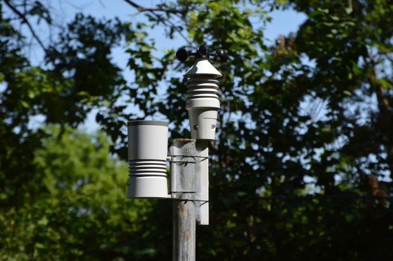
What Dobbins assembled over the following years was, by professional meteorological standards, a mess. His anemometer — the spinning device that measures wind speed — was built from soup cans. His rain gauge was calibrated with a ruler he'd machined himself. His barometric pressure sensor was adapted from an industrial component he'd salvaged from a decommissioned factory. His temperature and humidity instruments were housed in a hand-built wooden shelter that he'd painted white and mounted on a post in the middle of his back field, roughly a quarter mile from the nearest building.
That last detail turned out to be the most important thing about the entire setup.
Professional weather stations, particularly the older generation of NWS observation points, were frequently located at airports, on rooftops, or in other built environments. This made logistical sense — they needed power, communication infrastructure, and regular maintenance. But it introduced a systematic bias. Urban and suburban heat islands, wind shadows created by buildings, and the thermal effects of concrete and asphalt all subtly distort the readings from stations located near human infrastructure.
Dobbins's station was in a field. Surrounded by other fields. With nothing between it and the horizon in three directions. It was measuring the atmosphere the way the atmosphere actually behaved over the landscape that actually surrounded it.
Thirty Years of Being Right
Dobbins began comparing his forecasts — which he derived from his own observations combined with publicly available upper-atmosphere data — against NWS predictions for his county in the mid-1960s. He kept meticulous records. Notebooks, then index cards, then eventually a filing system that his family described as intimidating in its thoroughness.
The results were striking. For localized precipitation events — the kind of fast-moving summer storms that make farming decisions so consequential — Dobbins was right significantly more often than the official forecast. His timing predictions for storm arrival were, on average, more accurate by a margin his neighbors learned to take seriously. Local farmers began calling him before they called the radio.
By the 1970s, his reputation had spread enough that a researcher from the University of Illinois's atmospheric sciences department drove out to meet him. What she found was not a lucky amateur but a methodical observer who had, essentially, rediscovered a principle that professional meteorology had been slowly learning the hard way: location is everything in surface observation.
What the Scientists Made of It
The university study that eventually examined Dobbins's records — published in a regional meteorological journal in the early 1980s — was careful not to frame the findings as an indictment of the NWS. The researchers pointed out, correctly, that official stations serve multiple purposes beyond local accuracy, including the collection of standardized data that can be compared across regions and time periods. Standardization requires consistent placement protocols, even if those protocols introduce local distortions.
But the study did confirm what Dobbins's notebooks showed: a well-sited surface station in an open rural environment, operated by a careful observer, could produce local forecasts that outperformed regionally generalized NWS predictions for hyperlocal events. The findings contributed to a broader conversation within meteorology about station siting standards — a conversation that eventually led to the development of the Climate Reference Network, a system of specially sited stations designed to minimize the urban bias problem.
Dobbins never sought credit for any of this. He was pleased that the university found his records useful, and then he went back to his field and kept measuring.
The Stubborn Advantage of Being in the Right Place
Dobbins passed away in the early 1990s. His weather station was maintained by his son for several more years before eventually being retired. His notebooks are held by the University of Illinois.
What his story illustrates isn't that amateur science is better than professional science. It's that sometimes the most sophisticated tools in the world can be undermined by a simple placement mistake — and that the person standing in the right field with a soup-can anemometer and thirty years of patience can see things that a supercomputer, looking at data collected from the wrong location, simply cannot.
The atmosphere doesn't care about your credentials. It cares about where you're standing.